Printable Map Skills and Compass Vocabulary Activities Grades 2-5 - Word Search, Quizzes, Key
 By Educo
Price in USD. Local taxes calculated at checkout.
Buy 3 or more, save 20% from this shop
- 1 ZIP download · PDF, ZIP formats · US Letter + A4 · 300 DPI
- Buyer protection. Corrupt or mismatched files? Full refund.
Item details
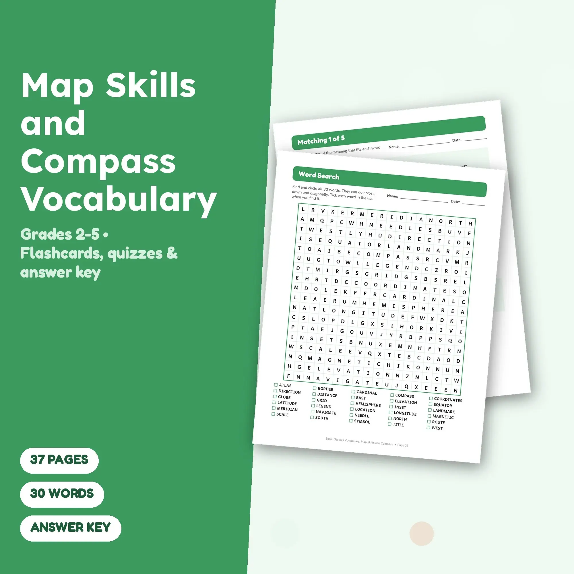
Map Skills and Compass vocabulary, ready to print: this 37-page study set covers 30 terms for Grades 2-5 and lets students meet every word in several different ways.
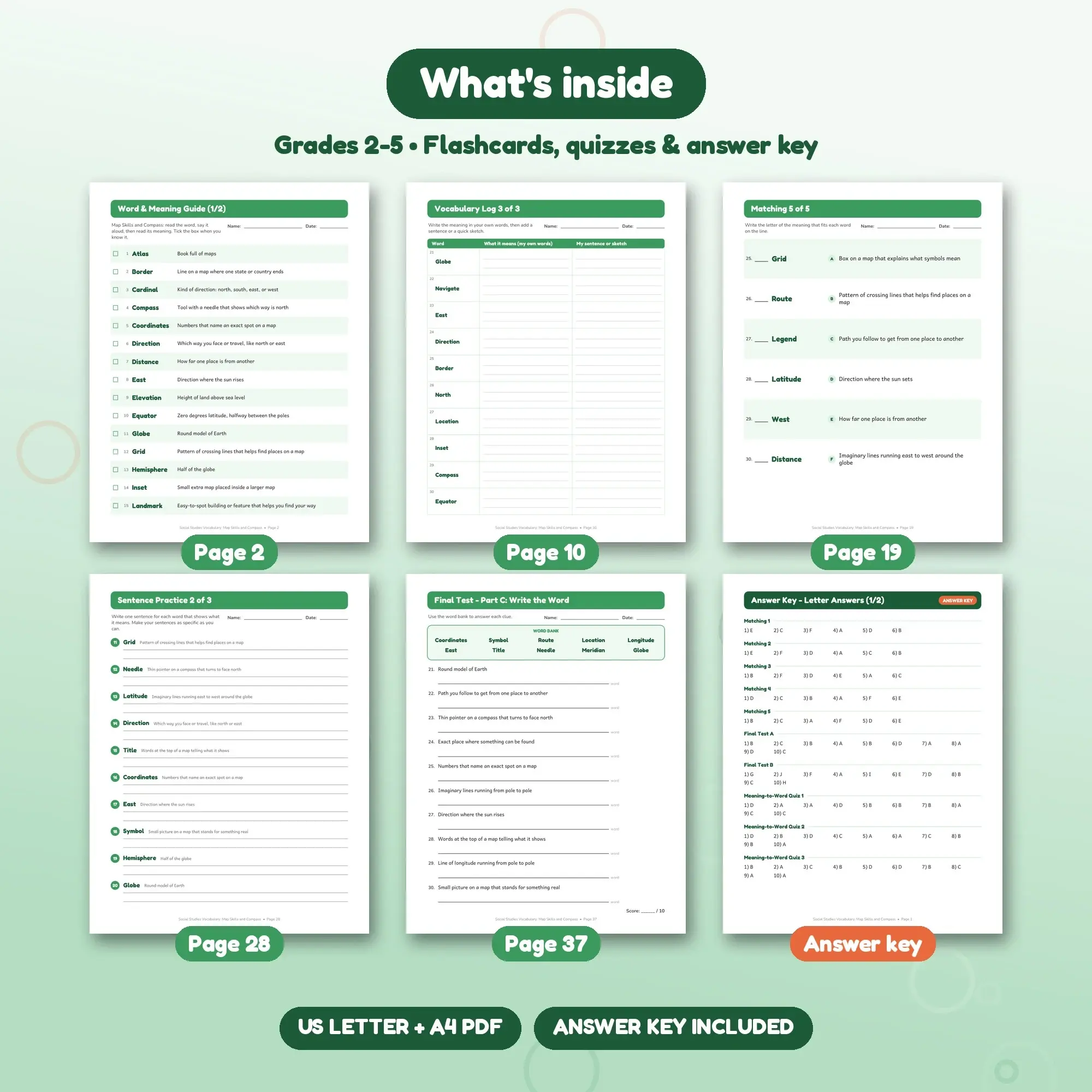
The set is made up of a cover page that lists everything inside plus all 30 words; an alphabetical word-and-meaning guide on 2 pages; 30 one-sided study cards, 8 per sheet, with a fold line that covers the meaning; a 3-page vocabulary log with the words already filled in and space for a meaning in the student's own words plus a sentence or sketch; eight fill-in word wall cards on one page (word, meaning, picture box); 3 one-page word maps with four boxes (own definition, facts, examples, non-examples or drawing) for words such as Compass, Navigate, East; 5 short matching worksheets with 6 words each, with the meanings in a shuffled lettered column; three write-in pages (10 clues each) supported by a word bank at the top; word scrambles in 3 sets of 10, each with the meaning printed as a clue; a single 30-word puzzle on an 18 x 18 grid with words running across, down and on the diagonal; sentence-writing sheets (3 pages, 10 words each) with the meaning shown as a reminder; a pair of true-or-false sheets (30 statements) where some meanings are swapped on purpose; three 10-question quizzes that start from the clue and ask for the word; and a final test on 3 pages: choose the word, match the meaning, and write the word from a bank (30 questions in total).
Meanings are short and written for students, for example Direction: Which way you face or travel, like north or east, and Elevation: Height of land above sea level.
The complete word list: Compass, North, South, East, West, Legend, Scale, Grid, Symbol, Title, Direction, Latitude, Longitude, Equator, Meridian, Hemisphere, Globe, Atlas, Route, Location, Distance, Border, Landmark, Cardinal, Needle, Coordinates, Elevation, Inset, Navigate, Magnetic.
You get a single ZIP with printable PDFs in US Letter and A4 sizes (37 pages each) and matching answer keys in separate files so students never see them by accident.
Pages use large print and roomy answer lines for small hands; a grown-up can read the clues aloud. Cards also work as a matching game, a sorting center or a partner quiz. Handy for centers, early-finisher folders, homework packets and substitute plans.
Works with Any PDF reader.
File specs
| Formats | PDF, ZIP |
|---|---|
| Dimensions | US Letter + A4 |
| Resolution | 300 DPI |
| Color space | sRGB |
| Downloadable files | 1 ZIP download · PDF, ZIP formats |
| Category | Planners & Printables |
| Last updated |
What you’ll download
- zipMap-Skills-and-Compass-Vocabulary.zip464 KB
License and usage
- Personal · $5.99
- Use the files in your own non-commercial projects: home prints, gifts, personal social posts and school work. Anything made with them can’t be sold.
- Commercial · $12.98
- Use the files in client work and in products you sell, up to 5,000 units across all products. Credit is appreciated but not required.
No license allows reselling, sharing or redistributing the original files as they are, including in free packs or AI training sets.